San Francisco, USA

Standard

Guess who’s back in America?

As much as I’ve loved being around the world, it’s somewhat of a relief to be back in the homeland, especially since San Fran is a place I visited a lot as a kid. Before I started my scientific study, I did some touristy sight-seeing stuff. I’ve done it all before, but never by myself, and I really enjoyed it.

I spent a day just wandering around the city. It was pretty great :).

But back to the reason I’m here- wibbly wobbly sciencey wiency stuff.

I realize I’m a nerd and that about not nearly enough of you understood that reference. I’m okay with that.

San Francisco is a city on the transform boundary of the Pacific Plate and the North American Plate. Transform boundaries are places where two plates are rubbing against each other, both moving in opposite directions

This leads to a LOT of friction, which is released through seismic activity. They have lots of mild earthquakes. In fact, there was an earthquake of 1.7 severity just yesterday. When an earthquake is that low on the Richter scale, you don’t even feel it.

These earthquakes, though, have been happening for 10 million years, and 22 years ago, they had an earthquake of 7.2 severity.

There is no volcanic activity associated with transform faults, as no rock is being melted and turned into magma.

So this marks the end of my journey. Tomorrow I pack up my stuff, say goodbye to the woman I’m staying with, and fly back to Penn State to report my findings!

Wish me luck!

-Uma


Reykjavik, Iceland

Standard

*Please keep in mind that this is an entirely fictitious account of a fictitious journey. Any resemblance to real events or people is purely coincidental.

Jetlag? stinks. big time.

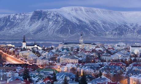
Today I’m in Iceland, more specifically Reykjavik. I am so glad this is a written blog because I have no idea how to pronounce that.

It’s not as cold here as I thought it would be. It’s actually fairly nice, about 50-59 degrees Fahrenheit. Iceland as a name, I guess, is misleading. That and the fact that it’s really far north.

This places is seriously beautiful, though. I mean, look!

But pretty pictures aside, I’m here in Iceland to study divergent plate boundaries- tectonic plates that are slowly spreading apart.

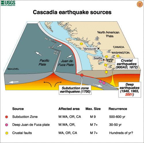
There are two tectonic plates in Iceland- the North American plate, and the Eurasian plate. For thousands and thousands of years, they have been drifting apart, and molten rock continuously forces its way up through the continuously expanding gap. It cools and hardens into new continental crust, ensuring the constant expansion of Iceland.

However, the molten rock doesn’t always necessarily ebb out of cracks evenly. It often pools and hardens into volcanic structures on the edges of the tectonic plates that continue to collect percolating magma for hundreds of years.

This means there are some pretty sweet looking volcanoes in Iceland.

Like this one:

And this guy:

Pretty incredible, right?!

Iceland’s most recent earthquake was of 4.8 magnitude 8 months ago.

The tectonic plates have been spreading for about 150 million years in the north and 90 million years in the south, and volcanic and seismic activity has been occurring for most of that time. More than 15 volcanoes have erupted in the last century alone.

The Mid-Atlantic Ride, a divergent plate boundary along the Atlantic Ocean floor, slices through Iceland. It is essentially an underground mountain range that is submerged except for, notably, Iceland.

Between tectonic plates, though, there is a large rift valley that expands and sinks every year.

This is the “gap” caused by the spreading tectonic plates, and is therefore lower than the surrounding land. The picture above has been taken from the edge of the North American plate and shows the distance to the Eurasian plate.

As the two plates pull apart, faults occur naturally on both sides, and the fracturing and movement results in earthquakes.

So that’s about it for the science portion of this.

I know I mentioned this earlier, but holy mother of dragons this place is so incredibly beautiful. I was hiking in the Thingvellir Rift Valley yesterday to take the photo above (actual photo credit: Sue Strickland) and can I just say that pictures really do not do it justice. The lakes, the mountains, the trees, the peace. It’s pretty incredible.

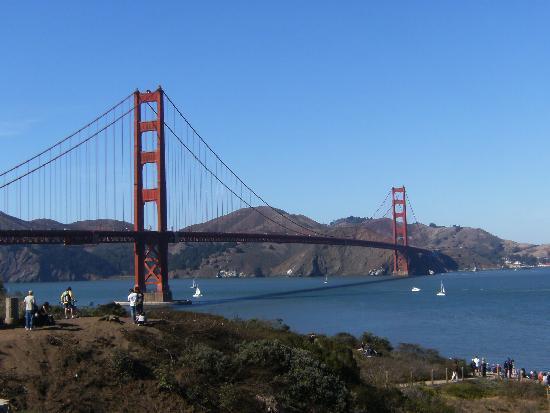
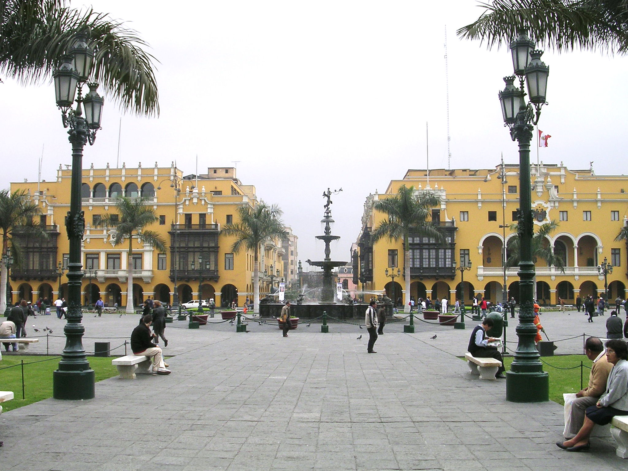
I’m staying with a really nice lady I found on Airbnb. She’s letting me stay in her extra bedroom, and every morning she makes us both breakfast! It’s really good, too. Woman can really fry an egg. She was a lot nicer than the couple I stayed with last week… They really did not appreciate my waking up at 4 every morning. Which I guess is understandable, but I did warn them I was there for research and would be getting up really early. It was totally worth it though. Lima was awesome :).

Alright, I appear to be getting to the point of tired (in a good way!) where I can no longer talk without rambling. I’m gonna sign off for now- see you guys next week!

Lima, Peru

Standard

*Please keep in mind that this is an entirely fictitious account of a fictitious journey. Any resemblance to real events or people is purely coincidental.

Hello! Today I am writing from the beautiful (though admittedly rather smoggy) city of Lima, Peru

Yay! For those of you who maybe haven’t glanced at a map in a while, Peru is in South America.The continental plate that forms most of South America is called (shockingly enough) the South American plate, which pushes up against the oceanic Nazca plate

Remember this picture?

When these two plates collide, the oceanic plate slides below the continental plate, which buckles from the pressure, creating a mountain range and a subduction zone.

“Mountain range? Like the Andes?”

Yep. Like the Andes.

There are several volcanoes in the Andes, and there is a rather complicated system of volcanic zones that scientists use to keep track of and predict volcanic activity.

Earthquakes are also fairly common by the Andes, with the most recent earthquake being a 6.1 on the Richter Scale 2 months ago.

This area has been historically full of tectonic activity- there is evidence of volcanic activity dating back to the Triassic Period (250-200 million years ago), and volcanic activity has occurred fairly regularly for about 10 million years.

The reason most of the Andes’ “mountains” are volcanoes rather than actual mountains has to do with the fact that the tectonic boundary here is a subduction zone, rather than a collision zone. This is important because when the aforementioned oceanic plate subducts beneath the lighter continental plate, it gets really hot. This is because the farther down it goes, the closer it gets to the mantel, and the closer it gets to the mantel, the more it melts.  When it melts, the lighter liquid rises slowly back through the plate as magma. It reaches the pressurized and buckled land near the surface, and eventually, it causes an explosion. In a collision zone, however, the two pieces of land simply push up against each other until they are forced to move upwards, creating a mountain range, much like the Himalayas

Earthquake activity in subduction zones is partly caused by plate slippage. The plate on the top builds up so much pressure due to friction and other factors that it slips down the subducting plate. This releases the existing pressure, but causes a lot of new pressure wherever the plate locks on again.

Another important factor in tectonic activity is the fact that cold oceanic crust is oftentimes slammed into the incredibly hot mantle, causing the surrounding crust to become much more brittle, increasing the risk of much more major earthquakes.

Subduction zones are also the only places where “deep quakes” occur. For the most part, earthquakes tend to happen within 20 kilometers of the surface. However, in subduction zones, earthquakes have occurred at depths reaching up to 700 kilometers.

Although this diagram illustrates what happens in the Cascadia subduction zone, it’s pretty easy to extrapolate from and illustrates the workings of a subduction zone nicely.

So far, my time here in Peru has been a blast! It’s been great getting to look at these things in person and meet the local people. I’m really looking forward to the next leg of my trip!

In which I introduce myself.

Standard

Hello! My name is Uma, although I will respond to a variety of things, including but not limited to “hey, you!”, and “the person with the stuff.” At this point in my life, I am 20 years old. I am studying geology at Penn State, and taking a month off to study various tectonic plate boundaries across the world- convergent subduction, divergent, and transformative.

First stop- Lima, Peru, a city on the cusp of a oceanic-continental subduction zone located near the Andes Mountains.


The next week-Reykjavik, Iceland. There, I will study a divergent tectonic plate boundary responsible for the constant expansion of Iceland.


And lastly, I will be visiting San Francisco to study the infamous San Andreas fault at work, the transform fault on my list.


Thanks for joining me on my journey! Enjoy the ride!

*Please keep in mind that this is an entirely fictitious account of a fictitious journey. Any resemblance to real events or people is purely coincidental.

Picture Sources:

http://www.platetectonics.com/book/images/Convergence1.gif

http://www.platetectonics.com/book/images/Divergent1.gif

http://www.platetectonics.com/book/images/Transformfaults.gif